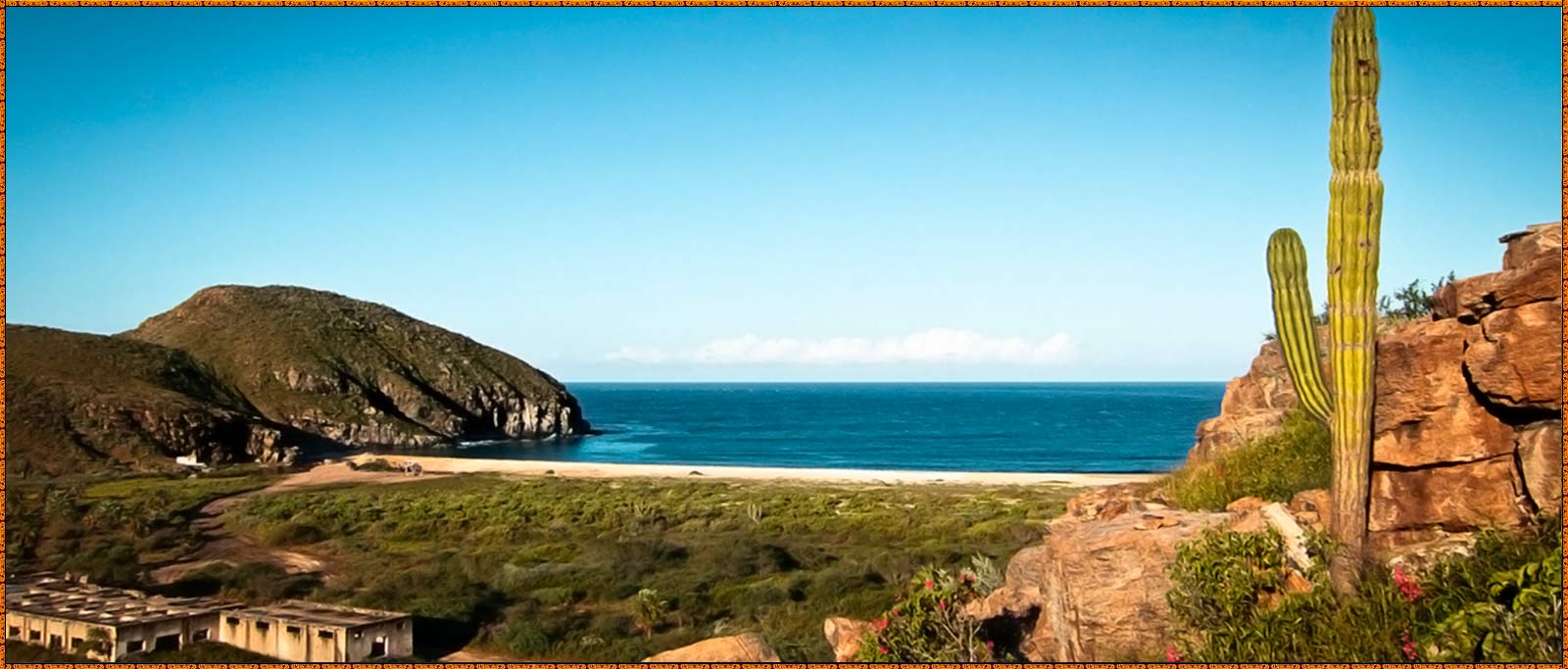
Todos Santos
Todos Santos is a small coastal town at the foothills of the Sierra de la Laguna Mountains, on the Pacific coast side of the Baja California Peninsula, about an hour's drive north of Cabo San Lucas on Highway 19 and an hour's drive southwest from La Paz. Todos Santos is located very near the Tropic of Cancer in the municipality of La Paz. The population was 5,148 at the census of 2010. It is the second-largest town in the municipality.
The mission at what is now Todos los Santos, Misión Santa Rosa de las Palmas was founded by father Jaime Bravo in 1723. In 1724 it was renamed Nuestra Señora del Pilar de La Paz. Located across the street to the southwest from the small town plaza, this mission contains the statue of the Virgin of Pilar, which is the focus of Todos Santos' main festival in October.
During the Mexican American War the Skirmish of Todos Santos, last battle of the war, was fought near the town on March 30, 1848.[2]
During the 19th century following the secularization of the missions, Todos Santos thrived as the Baja sugarcane capital, supporting eight sugar mills at the end of the 19th Century. Only one existed by the time the town’s freshwater spring dried up in 1950 and that last mill closed in 1965.
Todos Santos faced a bleak future until, the spring came back to life in 1981 and the Mexican Government paved Highway 19 in the mid 1980s. The highway brought tourists and the rich farmlands have been revived. The town now prospers from farming vegetables, chilies, avocados, papayas and mangoes; also from fishing and ranching.[3][4]
Contemporary Todos Santos
More recently, there has been a gradual increase in tourist activity and a boom in real estate development. Handicraft shops, owner-operated art galleries featuring landscape paintings of local scenes (some artists from Guadalajara and other parts of Mexico also exhibit works in Todos Santos,) upscale restaurants, boutique hotels and restored colonial buildings have contributed to the gentrification and redevelopment of the town. The Hotel California is a favorite stop here because of the name association with the song made famous by the Eagles, even though the song does not specifically reference this particular hotel, nor any other existing hotel.
There are many beautiful beaches within a 15 minute drive of Todos Santos. However, some of the area’s beaches, with rip tides, undertows, and fairly steep drop offs that are close to shore, are not considered safe for swimming. Playa Las Palmas and Playa Los Cerritos are great beaches for swimming and shell collecting. San Pedrito Point, Los Cerritos and other local surf breaks attract surfers from around the world. There are many accommodations both at San Pedrito and at Cerritos beach.
Todos Santos, Baja California Sur, was named a "Pueblo Mágico" in 2006.
| LOCATION |
|---|
| Property Name: Las Tunas |
| Street Name: Playa Ocotillo, |
| Zone: Pacific |
| Area: Pacific North |
| Community: Todos Santos |
| Subdivision: Las Tunas |
| General Description |
|---|
| Current Price: 14000000 |
| Price: 14000000 |
| Lot M2: 3520002 |
| Lot Dimensions: 440 x ?? |
| Ocean Front Meters: 440 |
| Primary View: Oceanfront |
| Secondary View: Mountain |
| Subcommunity: no |
| Mstr Plan Community: no |
| Location, Taxes & Legal |
|---|
| Taxes: 25000 |
| Contract Data |
|---|
| Status: Active |
| Connectivity |
|---|
| Distance to Power Service: |
| Distance to Phone Service: |
| Property Features |
|---|
| Distance From Paved Road: |
| Road Type to Property: |
| Title: |
| Water: |
| Sewage: Septic |
| How To Show: Agent To Accompany |
| Topography: Gentle Slope |
| Potential Use: Commercial Lot; Development Parcel; Residential Lot |


